If you’ve ever walked past a wind farm on a crisp, cool morning and wondered how technicians catch a tiny heat-emitting fault in a turbine blade before it becomes a catastrophic failure, or how a commercial building’s maintenance team spots hidden electrical hotspots in a switchgear closet without shutting down operations, chances are a drone carrying a thermal camera was there first. As a supplier of inspection drones built for exactly this kind of work, I get asked all the time: how do these machines actually pull off thermal inspections? It’s not just flying a camera around and calling it a day—there’s a lot of careful engineering, training, and on-the-ground know-how that goes into every single successful scan. Inspection Drone
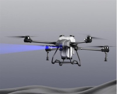
First, let’s cut through a common myth: thermal cameras aren’t like regular HD cameras. A regular camera captures visible light, which is what our eyes can see. A thermal camera, by contrast, detects infrared radiation, the invisible heat given off by every object above absolute zero. Every material emits infrared energy at a rate determined by its temperature, emissivity (how well it gives off heat, rather than absorbing or reflecting it), and surface texture. For an inspection drone, this means pairing a high-stability drone platform with a calibrated thermal camera payload that can pick up even tiny temperature differences—sometimes as small as 0.01 degrees Celsius—across a target.
The foundation of a good inspection drone for thermal work starts with the airframe. You can’t use a off-the-shelf consumer drone for this, and I’ll tell you why: consumer drones are built for fun and casual photos, not for the consistent, precise flight needed to capture reliable thermal data. Thermal inspections require stable hover, no vibration that would blur the camera’s readings, and the ability to hold a consistent distance from a target—whether that’s a 300-foot turbine or a row of rooftop solar panels at dusk. My team designs our inspection drones with vibration-dampened mounts specifically for thermal payloads, because even a tiny wobble can create false hotspots or skew temperature readings. We also build in redundant navigation systems, like GPS and visual odometry, so if one signal drops mid-flight (say, near a dense tree line or a tall building), the drone doesn’t drift and ruin a scan that took hours to plan.
Next comes the thermal camera itself, and this is where calibration matters more than most people realize. A thermal camera needs to be calibrated before every single mission, not just once when it’s manufactured. Here’s why: even small changes in air temperature, humidity, or the angle of the sun can throw off a camera’s readings. For example, if you’re scanning electrical substations on a hot summer day, the ambient air temperature is 95 degrees Fahrenheit, and the camera is slightly warm from sitting in the sun, it might misread a 100-degree hotspot as 105 degrees if it’s not calibrated properly. Our team includes a pre-flight calibration step as non-negotiable—we use a black body reference target, a device that emits a known, stable temperature, to make sure the camera’s readings are accurate before takeoff. We also use radiometric thermal cameras, not just the simpler non-radiometric ones that only show color gradients. Radiometric cameras output actual temperature data for every pixel, which is what maintenance teams need to make actionable decisions: “that connection is running 20 degrees hotter than it should be, so we need to replace it before it fails.”
Once the drone is in the air, the inspection flight is planned with purpose, not just route. A lot of new drone pilots think they can just fly around a wind turbine and get a scan, but that’s a fast way to miss a fault. For thermal inspections, pilots follow strict, industry-standard paths that ensure they’re at the correct angle and distance from every target. For example, when inspecting a turbine’s blade, the drone flies in a spiral pattern around the blade, staying 10 to 15 feet away, at a 90-degree angle to the blade’s surface. This distance is important: if a thermal camera is too close, it might pick up only the surface temperature of the camera’s lens, not the blade; too far, and the image resolution drops so much that a tiny hotspot is impossible to see. For electrical switchgear inside a building, the drone might fly through open vents or windows at a consistent altitude, pausing for 10 seconds over each panel to capture a clear thermal reading, since moving too fast can blur the radiometric data.
Weather is another huge factor that shapes how a thermal inspection goes. You can’t run a thermal scan in the middle of a sunny afternoon, for example, because the sun is heating up all surfaces evenly, masking small temperature differences. The best times for thermal inspections are early morning, before the sun has warmed the target, or on a cloudy, cool day, when temperature contrasts are sharp. Wind is also a concern: even a mild 10-mile-per-hour wind can cool a hot hotspot, making it harder to detect, or push the drone off its flight path. That’s why our drones are built with wind resistance up to 25 miles per hour, and our pilots are trained to abort a mission mid-flight if conditions shift. I’ve had to call off an inspection of a factory’s electrical system twice, once when a sudden gust of wind picked up, and once when a late afternoon sun peeked out behind the clouds, washing out the thermal contrast—better to reschedule than to have data that’s useless for the client.
Once the drone lands, the real work begins: processing the thermal data. A single thermal inspection mission can produce thousands of radiometric images, and raw data like that is hard to parse manually. Our team partners with software tools that can stitch images together into a 2D or 3D model of the target, then highlight any anomalies automatically. For example, if a solar panel has a hot spot (a sign of delamination or cell damage), the software will flag it with a color code, so a technician doesn’t have to scroll through every image. The software also takes into account variables like emissivity—something that trips up a lot of people new to thermal imaging. Emissivity is the measure of how well a material emits infrared energy; a shiny metal panel has low emissivity, so a thermal camera will read its temperature lower than it actually is, while a painted surface has high emissivity, so it reads more accurately. Our pre-flight software settings adjust for the emissivity of each target before the drone takes off, so the data is already calibrated when it’s time to process.
I’ve seen this process work firsthand on jobs that would have been impossible with human inspectors. Last year, a wind farm client hired us to inspect 20 turbines in a remote mountain range, where access by road was only possible for a few days a month, and climbing the 300-foot turbines was too dangerous after a recent storm left ice on the blades. Our drone completed the inspection in 3 hours, captured thermal data that showed a faulty gearbox in 2 turbines, and the client was able to schedule repairs before the blades failed, saving an estimated $50,000 in downtime and replacement costs. On the flip side, I’ve seen inspections go wrong when clients tried to cut corners: they bought a cheap, non-radiometric drone, skipped calibration, and ended up with data that had a 20-degree error rate, leading to a false alarm that cost them unnecessary maintenance work. That’s why I always tell potential clients that thermal inspection drones aren’t a one-size-fits-all tool—they need to be built for the specific mission, and the team operating them needs to know how to use them.
Another part of what makes our drone thermal inspections effective is the compliance factor. All of our drone operations are certified by aviation authorities, so pilots don’t have to worry about airspace restrictions, no-fly zones near airports, or privacy concerns when flying over commercial buildings or residential areas. We also follow industry standards set by organizations like the American Society of Mechanical Engineers (ASME) for thermal inspections, so our data is accepted for regulatory purposes. A lot of new inspection drone providers skip these compliance steps, which can lead to fines or rejected inspection reports. That’s a big part of why our clients come back: they don’t just get a scan, they get a report they can trust.
At the end of the day, thermal inspections with drones are a combination of technology, skill, and attention to detail. It’s not just about having a fancy camera on a flying machine—it’s about calibrating that camera correctly, planning the right flight path, accounting for environmental conditions, and processing the data into something actionable. As a supplier, we work closely with our clients to tailor every drone, payload, and mission to their specific needs, whether that’s inspecting wind turbines, solar farms, electrical substations, commercial roofs, or industrial equipment.

If you’re looking to upgrade your maintenance program, catch faults before they turn into costly failures, or reduce the risk of sending workers to dangerous heights or restricted areas, our team can help you design the right thermal inspection drone solution for your operations. We offer custom payloads, pilot training, and end-to-end data processing to make sure you get reliable, actionable results every time.
Agricultural Drone References
- American Society of Mechanical Engineers. (2020). Standard Practice for Thermal Inspection of Wind Turbine Components. ASME PTC 45-2020.
- Federal Aviation Administration. (2022). Part 107 Small Unmanned Aircraft Systems Regulations for Commercial Operations. FAA-2022-0001.
- Thermal Imaging Technology Association. (2019). Guide to Radiometric Thermal Camera Calibration for Industrial Applications. TITA Technical Bulletin 003.
- International Society of Automation. (2021). Drone-Based Inspection for Electrical Distribution Systems. ISA-TR 108.01.02-2021.
Shandong Lesong Drone Technology Co., Ltd.
As one of the most professional inspection drone manufacturers in China, our products have good reputation in the market. Please rest assured to wholesale high quality inspection drone for sale here from our factory. Good service and punctual delivery are available.
Address: Yuncheng County, Heze City, Shandong Province
E-mail: Ella36988@163.com
WebSite: https://www.china-uavfactory.com/
